
Tracking 30 Years of Sea Level Rise
August 19, 2022
20,286
83
0.41%
Search the Record
IndexedEvery word spoken in this episode is indexed. Type any phrase to jump straight to the moment it was said.
Type any word or phrase that may have been spoken. Click a result to seek the player to that exact moment.
Try a name, a topic, or a quoted line
Archived Nasa Climate Change Episodes Around August 19, 2022
See what was published immediately before and after this episode.




 0:16Now Playing
Tracking 30 Years of Sea Level Rise


YouTube Description
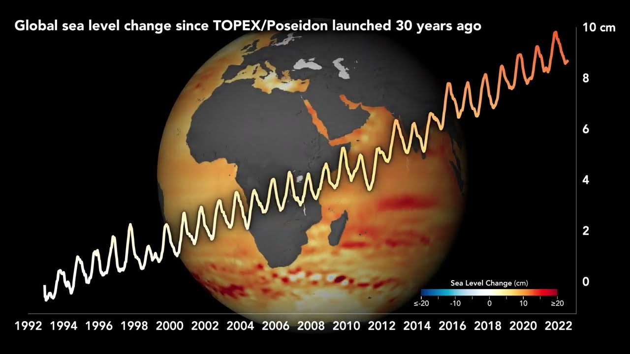
as posted by the channelThirty years ago, scientists and engineers launched a new satellite to study the rising and falling of seas over time, a task that once could only be done from the coast. TOPEX/Poseidon rocketed into space on August 10, 1992, and started a 30-year record of ocean surface height around the world. The observations have confirmed on a global scale what scientists previously saw from the shoreline: the seas are rising, and the pace is quickening.
Scientists have found that global mean sea level—shown in the line plot above and below—has risen 10.1 centimeters (3.98 inches) since 1993. Over the past 140 years, satellites and tide gauges together show that global sea level has risen 21 to 24 centimeters (8 to 9 inches). That's like covering the contiguous U.S. in about 16 feet (about 5 meters) of water. Recent rates have been unprecedented over the past 2,500-plus years.
Learn more:
Sentinel Indexing in Progress
Metadata and chapters are available. Claim extraction for this episode is pending.
All video content is delivered via YouTube embedded players in accordance with the YouTube Terms of Service. Sentinel provides research tools that promote discovery and accountability across political media.