
Bloomberg News
@Bloomberg-News·2.8M subscribers·40.1K videos
Hurricane Sally Menaces New Orleans and the Alabama Coast
Posted
September 14, 2020
Views
21,642
Likes
123
Comments
78
Engagement
September 14, 2020
21,642
123
78
0.93%
Every word spoken in this episode is indexed. Type any phrase to jump straight to the moment it was said.
Type any word or phrase that may have been spoken. Click a result to seek the player to that exact moment.
Try a name, a topic, or a quoted line
Episode Timeline
Every episode in order around the one you’re watching — click any card and the page flips straight to it.
 0:58Now Playing
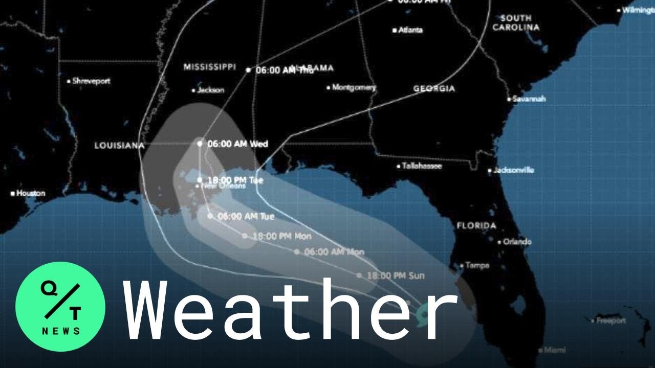
Tropical Storm Sally is set to reach New Orleans and southeastern Louisiana early this week, bringing with it a dangerous storm surge, flooding rains and potential to cause as much as $4 billion in damage and losses.
Louisiana Governor John Bel Edwards declared an emergency as the state braces for its second hit in a month, and New Orleans Mayor LaToya Cantrell issued a similar warning for the city. Sally has also sparked evacuations on some offshore energy platforms. Landfall is likely to be Tuesday morning.
Sally’s winds could reach 85 miles (137 kilometers) per hour as it approaches southeast Louisiana, possibly near the mouth of the Mississippi River, a little less than expected earlier. It would be a Category 1 hurricane on the five-step Saffir-Simpson scale.
Hurricane and storm surge warnings have been posted for the coastal region, including New Orleans, the National Hurricane Center said in an advisory on Sunday. The storm could raise ocean levels 7 to 11 feet (2-3 meters) at the mouth of the Mississippi River, which could overtop some levees.
“Sally is likely to become a very dangerous storm, with forecasts of it slowing down and strengthening as it approaches land,” said Jim Rouiller, lead meteorologist with the Energy Weather Group. “A period of rapid intensification remains on the table.”
The storm’s track has shifted to the west, which means the threat to New Orleans is rising and it could potentially lead to between $2 billion to $4 billion in damage and losses, said Chuck Watson, a disaster modeler with Enki Research. That price tag could rise even more if Sally gets stronger or takes more time moving through the area, or if water overwhelms flood control systems in New Orleans.
Sally will sweep the eastern edge of the offshore production area, probably halting oil and natural gas drilling for a short time and adding further disruption to the industry, Rouiller said. Hurricanes Marco and Laura, as well as Tropical Storm Cristobal, all halted work across the Gulf this season.
Chevron Corp. said Saturday it’s evacuating workers and shutting in production at its Blind Faith and Petronius platforms. The Louisiana Offshore Oil Port has suspended operations at the Marine Terminal as Tropical Storm Sally approaches in the Gulf of Mexico, according its website.
Mississippi River bar pilots will also halt operations Sunday.
Along with its storm surge, which can vary due to tides and exactly where the storm makes landfall, Sally will bring 8 to 16 inches of rain across the Gulf Coast from Louisiana to Florida, the hurricane center said. Some areas could get as much as 24 inches (61 centimeters) and heavy rain is forecast to spread well inland later in the week.
“Heavy rain and surge are probably the two biggest sources of damage,” said Adam Douty, a meteorologist with AccuWeather Inc. “There could be flooding issues across a lot of these low lying areas.”
Sally is 2020’s 18th named storm in the Atlantic. That’s the earliest the mark has been reached in records going back to 1851, said Phil Klotzbach, lead author of Colorado State University’s seasonal hurricane forecast.
The previous record was set by Stan, which formed in October 2005. So far seven storms have hit the U.S. in 2020, including Laura, which devastated southwest Louisiana, and Hurricane Isaias, which temporarily knocked out power to millions in the Northeast.
In addition to Sally, Tropical Storm Paulette is forecast to strengthen into a hurricane as it nears Bermuda late Sunday; a hurricane warning has been issued. Another Atlantic storm, Rene, has weakened to a tropical depression.
It’s possible there could be five tropical cyclones in the Atlantic soon, which hasn’t happened since September 1971, said Jim Rouiller, lead meteorologist with the Energy Weather Group.
Another tropical depression, currently dubbed “20,” could soon form into Tropical Storm Teddy and is about 2,030 miles east of the Caribbean Leeward Islands. Yet another area of low pressure sits west of the Cabo Verde Islands.
Subscribe to our YouTube channel
QUICKTAKE ON SOCIAL:
Follow QuickTake on Twitter: twitter.com/quicktake
Like QuickTake on Facebook: facebook.com/quicktake
Follow QuickTake on Instagram: instagram.com/quicktake
Subscribe to our newsletter
Email us at quicktakenews@gmail.com
QuickTake by Bloomberg is a global news network delivering up-to-the-minute analysis on the biggest news, trends and ideas for a new generation of leaders.
Sentinel Indexing in Progress
Metadata and chapters are available. Claim extraction for this episode is pending.
All video content is delivered via YouTube embedded players in accordance with the YouTube Terms of Service. Sentinel provides research tools that promote discovery and accountability across political media.